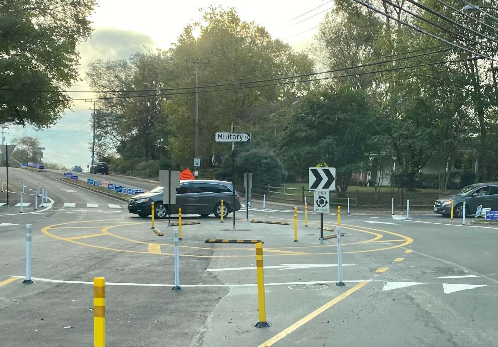
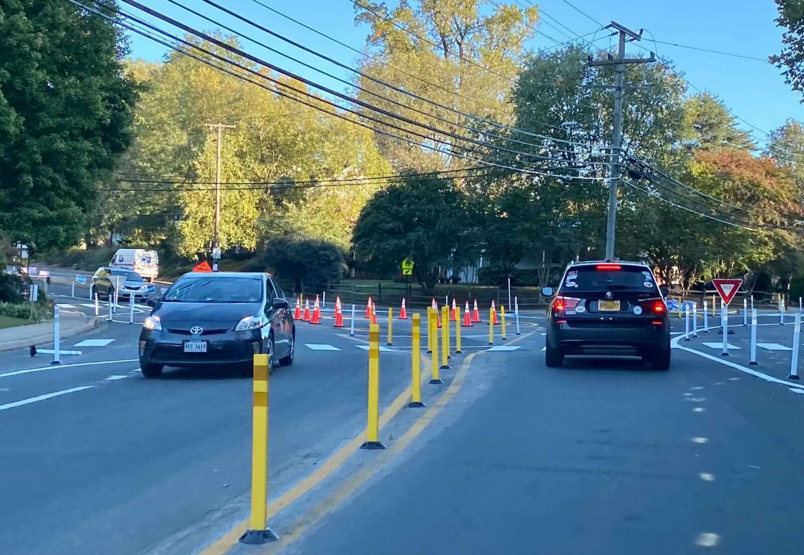
(Updated at 1:30 p.m.) There’s a new temporary traffic circle along Military Road aimed at improving safety where it intersects with Nelly Custis Drive.

Where there used to be a stop sign for traffic on northbound Military Road, the county has added paint lines, bollards and raised temporary curbs, and partially demolished a median. The work was completed Saturday, according to a spokesman with the Arlington Department of Environmental Services.

The one-lane roundabout at the intersection in the Donaldson Run neighborhood was completed after the county resurfaced Nelly Custis Drive as part of its annual street maintenance program.

“This pilot project, in conjunction with the Vision Zero transportation safety program, will test the effectiveness of a roundabout for improving pedestrian safety and reducing vehicle speeding at the intersection,” according to the county. “It will be in place for one year to allow data collection of real-world conditions, and since it’s temporary, it can be adjusted as needed or removed easily if it doesn’t work.”

The county will study traffic patterns to determine whether to keep the roundabout or install a lighted intersection, per a county webpage on the project.

“Military Road and Nelly Custis Drive intersection safety improvements will focus on driver yield rates, shortening crossing distances for people walking through the intersection, providing predictable turning movements [and] reducing vehicle speeding,” the website says.

Some neighbors are displeased with the new traffic configuration. An October newsletter from the Old Glebe Civic Association called the changes “unwanted.”

The civic association said it has repeatedly expressed its opposition to the potential project for four years, and it would like to see the old traffic pattern restored after the study.

“OGCA pledges continued opposition to the roundabout,” it said. “Other civic associations have concurred with OGCA that the project is overly expensive, will not improve traffic safety, and will unnecessarily slow movement along Military Road.”

Per DES data, about 11,000 vehicles pass through the intersection daily. In a presentation this summer, county staff said conversions to roundabouts reduce pedestrian crashes by 27%, and conversions from stop-controlled intersection reduce injury crashes by 82%.

But OGCA argues that crash data for the intersection doesn’t merit the change.

“In August, OGCA argued that the… construction cost was unjustified given little evidence of any safety concerns,” the newsletter continues. “Only three accidents have occurred over the past eight years (two involving bicycles) out of the approximately 32 million vehicles that passed through the intersection during that period. Our letter also said removal of the stop sign and bike lane increases danger for pedestrians — particularly school children during morning rush hour — and also for bicyclists.”

Bike lanes were converted to “sharrows,” or arrows reminding drivers to share the road with cyclists, per a planning document.
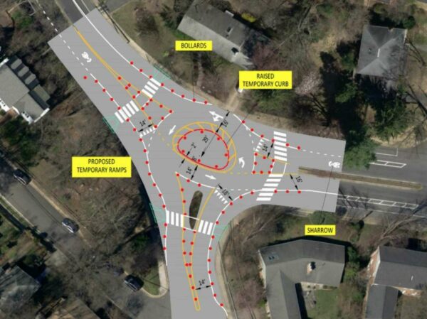
The Military Road and Nelly Custis Road intersection roundabout (via Arlington County)

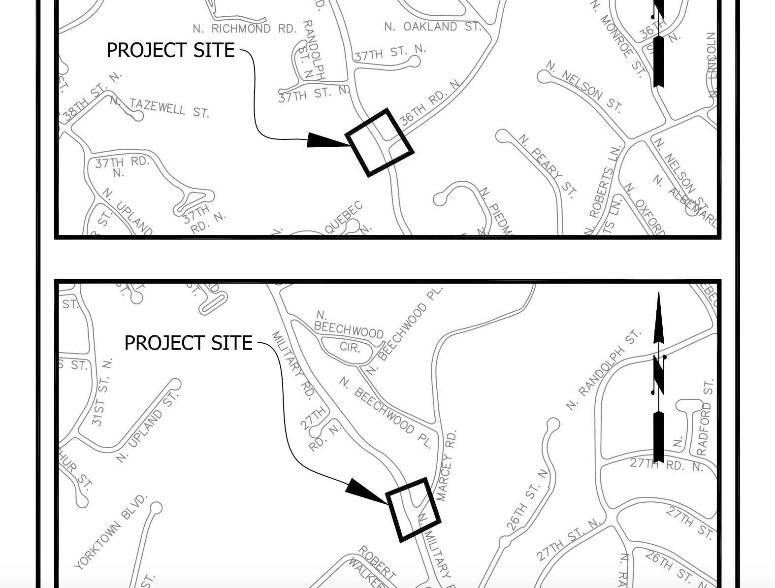
This is the last of three intersections — including those at Marcey Road and 36th Road N. — to be changed as part of a project aimed at improving safety along Military Road.

“These intersections were identified in a 2004 Arterial Transportation Management Study that suggested several recommendations to improve safety for all modes of transportation in the Military Road corridor,” according to DES.

Some local residents said in public comments that they supported the roundabout.

“As 25-year residents who live one block from this intersection and who walk, ride bikes, commute, and use the ART bus, we believe that a safer solution is needed due to excessive speed; drivers who fail to yield to pedestrians; and increased traffic volume,” said one couple.

The county website says the key takeaways for traveling through a roundabout are:

  • Always yield to pedestrians and cyclists at the crosswalks
  • When entering the roundabout, yield to vehicles and cyclists inside the roundabout
  • Signal when exiting the roundabout
Dave Grohl Rocks Local Studio — “Dave Grohl doesn’t seem terribly interested in taking a day off. Shortly after the 9:30 Club announced the Grohl-led Foo Fighters would play a surprise show Thursday, the former Nirvana drummer reunited with D.C.-based punk rockers, at Inner Ear Studio — the legendary and soon-to-close Arlington, Virginia, recording studio owned by Don Zientara.” [WTOP]

Fmr. Fire Chief on Arlington’s 9/11 Response — “‘It was truly an all-hands-on-deck endeavor,’ Schwartz said at the historical society’s annual banquet, held Sept. 9 at Washington Golf & Country Club. ‘We’re all in this together. There’s not a single agency or even a single jurisdiction that can handle this by themselves.’ Schwartz pointed to the county’s then-fire chief, Edward Plaugher, for his work building relationships with agencies like the FBI. Plaugher ‘was ahead of his time’ in being concerned about terrorism.” [Sun Gazette]

Night Paving at Busy Intersection — “Nighttime paving continues overnight this week at the Langston Boulevard (Lee Highway)-Glebe Road intersection improvements project… lasting into Friday, Sept. 17.” [Twitter]

Nicecream Hits Rocky Road — Nicecream, the handcrafted ice cream shop that expanded after finding success with its first location in Clarendon, is closing its Shaw store in the District. [PoPville]


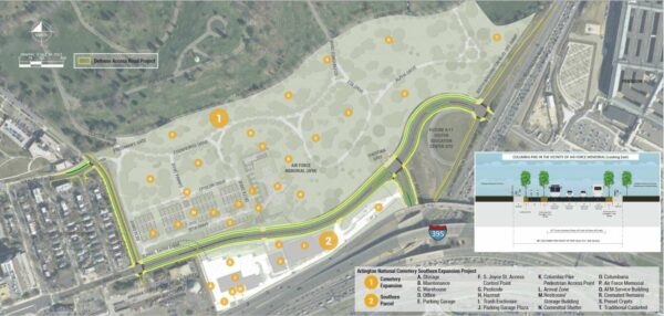
Map of the Arlington National Cemetery Expansion and Defense Access Road Project (Photo via US Federal Highway Administration)

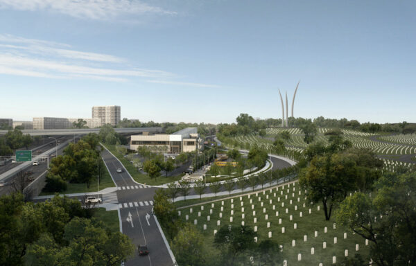
Construction to realign the eastern end of Columbia Pike, which is part of the project to expand Arlington National Cemetery, is expected to start soon.

The Arlington National Cemetery Defense Access Roads (ANC DAR) Project will realign Columbia Pike from east of S. Oak Street to Washington Blvd (Route 27). It will also modify the S. Joyce Street intersection, change the Columbia Pike and Washington Blvd interchange, and replace Southgate Road with an added segment of S. Nash Street.

Because of this, and as of early last month, parking is now permanently prohibited on Southgate Road between S. Oak Street and Columbia Pike.

Construction is expected to start in the early fall and be completed within four years, by summer of 2025, a Federal Highway Administration (FHWA) spokesperson tells ARLnow. This timeline is slightly pushed back from what’s listed on the FHWA project page.

The project will also add a new sidewalk and a shared-use trail, improve bicycle facilities, add street lighting, and put utility lines underground. FHWA’s project page also notes that the work done will be consistent with Arlington County Master Transportation Plan and Columbia Pike Multimodal Street Improvements Project. No residents will be displaced, though construction may bring added noise and traffic disruptions to the nearby Foxcroft Heights neighborhood.

All of this is being done to accommodate a 70 acre southern expansion of Arlington National Cemetery. It will add about 60,00 burial sites, including an above-ground columbarium, which will allow the cemetery to continue burials through the 2050s. The expansion will also bring the Air Force Memorial within cemetery grounds.

This project, particularly the modification of the Columbia Pike and Washington Blvd interchange, will also provide space for the 9/11 Pentagon Memorial Visitor Education Center. Construction on that is expected to start late 2023 with a completion set for two years later.

Rendering of the planned Columbia Pike realignment and the 9/11 Pentagon Memorial Visitor Education Center (Photo courtesy of Pentagon Memorial Fund, Inc./Fentress Architects)

While this realignment project has been long awaited, it hasn’t happened without some proverbial bumps in the road. Initially, the Army proposed a land exchange agreement with the county where the federal government would acquire the land from the county that was needed for the expansion. In exchange, the county would get “all land south of a realigned Columbia Pike to meet a variety of public facility needs.”

But, in 2017, the Army decided against the land exchange agreement, leaving the county “disappointed.”

Then, last summer, the federal government filed a civil suit to claim through eminent domain nine acres of land from Arlington County. The feds offered the county $10 for the land, but Arlington County Attorney Steve MacIsaac told DCist/WAMU in November 2020 that wasn’t going to cut it.

However, in January 2021, the Arlington County Board unanimously approved an agreement with the state, the Army, and the U.S. Department of Transportation that essentially provided the needed land in exchange for the feds paying for nearly all of the $60 million project. The county is only responsible for $500,000 to design a multi-use trail along Washington Blvd.


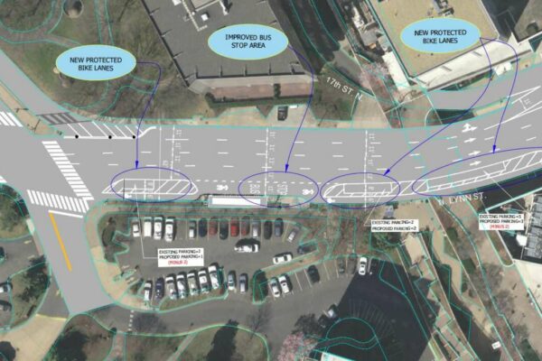
Part of the proposed resurfacing changes for N. Lynn Street (via Arlington County)

Arlington County plans to resurface a stretch of N. Lynn Street in Rosslyn to improve the driving and cycling experience.

The project is part of the county’s annual effort to resurface about 100 lane miles of roadway, prioritizing those in the most need of upgrades and those adjacent to development, schools or county-led capital projects. It is the second of two “complete streets” resurfacing projects proposed for 2021, the other being changes to Wilson Blvd in the Bluemont neighborhood.

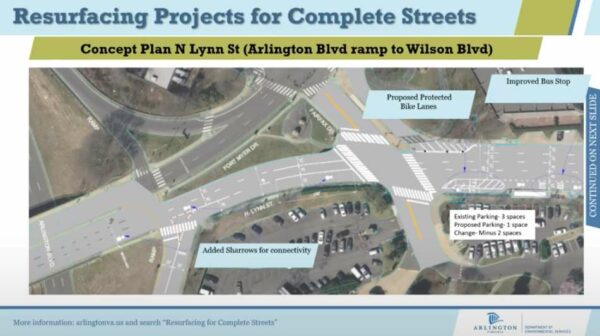
The plans for N. Lynn Street extend from the exit ramp for Arlington Blvd (Route 50) to Wilson Blvd. Proposed changes include adding “sharrows” — encouraging drivers to share the road with cyclists — connecting with existing bike lanes, plus buffering existing bike lanes, improving markings for a bus stop, and adding markings where drivers have to cross a bike lane to turn right.

This concept design accommodates the existing traffic by maintaining the same vehicular lane configurations, it adds additional separation between people driving and biking with protected and buffered bike lanes, it enhances the network connectivity with improved bike markings, and it improves visibility of right turn conflicts with the application of green markings,” said county transportation planner Catherine Seebauer during a recorded presentation.

A segment of N. Lynn Street that will be resurfaced (via Arlington County)

Right after the Arlington Blvd exit ramp, the county proposes adding northbound bike “sharrows” — markings indicating where cyclists and vehicles have to share the road — that will link up to the existing bike lane after the intersection with Fairfax Drive.

“That exit ramp is a VDOT-controlled road, so Arlington County is somewhat limited in what changes we can make there, but a reconfiguration of those on-off ramps is being looked at as part of [Core of Rosslyn Transportation Study], so long-term changes are in development for that intersection,” Seebauer said.

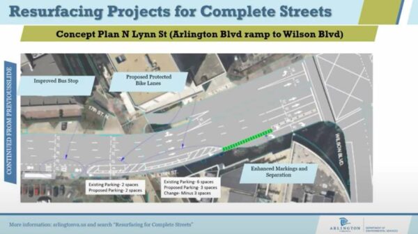
The vehicle lanes will be narrowed after Fairfax Drive, though they will still meet the county’s standard width of 11 feet, she said.

“The extra room allows us to provide more room for other facilities,” she said, including upgrading the existing bike lanes to be protected bike lanes. “They will be separated from vehicle lanes by parked vehicles and a small buffer strip.”

A segment of N. Lynn Street that will be resurfaced (via Arlington County)

Where the bike lane merges with an existing bus stop, the bus stop markings will be improved. Further up, close to the intersection with Wilson Blvd, green paint and bollards will alert drivers and cyclists about a conflict point, where drivers have to cross the bike lane to make a right turn.

From the exit ramp to Wilson Blvd, four parking spaces will be removed to improve sightlines, Seebauer said.

An online comment period for the project closed yesterday (Tuesday). The resurfacing work will be done later this summer and fall.


Update at 3:25 p.m. — The closure has been extended due to flooding at the construction site.

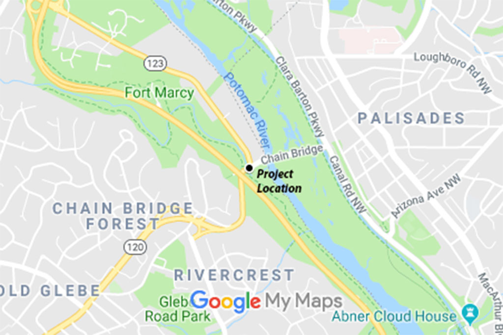
All lanes of N. Glebe Road between Military Road and Chain Bridge Road, in the northern tip of Arlington, will be closed for construction starting Friday.

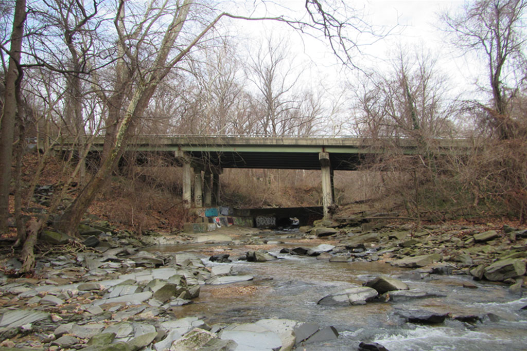
The nine-day closure is the culmination of the $10 million rehabilitation project for the nearly 50-year-old bridge over Pimmit Run, just before Chain Bridge. Between Friday, Aug. 13 and Monday, Aug. 23, crews will work to replace the entire bridge deck and its underlying beams.

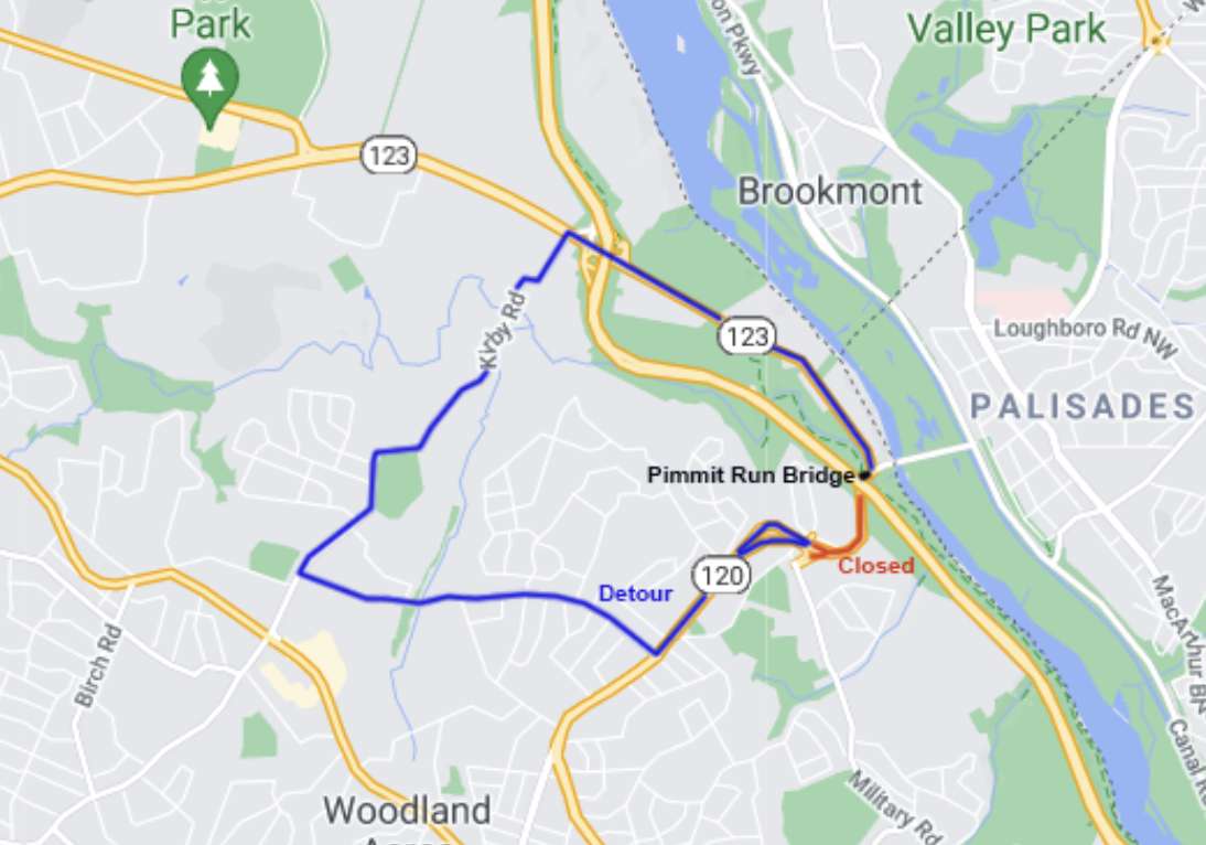
A winding detour around the closure, through parts of Arlington and McLean, will be put in place. Pedestrians and cyclists hoping to cross Pimmit Run will have an on-demand shuttle available to them during the closure, according to the Virginia Dept. of Transportation.

More from a VDOT press release:

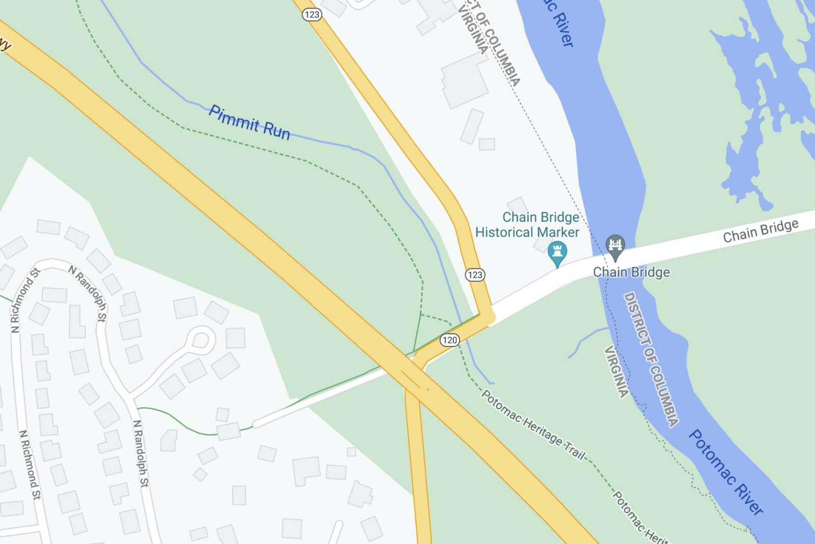
North Glebe Road (Route 120) between Military Road and Route 123 (Chain Bridge Road) will be closed to traffic for about nine days beginning Friday night, Aug. 13 to efficiently replace the entire bridge deck and beams over Pimmit Run, just west of Route 123, according to the Virginia Department of Transportation.

North Glebe Road will close at 10 p.m. Aug. 13 and is scheduled to reopen to traffic by 5 a.m. Monday, Aug. 23.

Vehicle traffic will be detoured via Route 123, Kirby Road (Route 695) and Chesterbrook Road (Route 689) back to North Glebe Road.

To help pedestrians get around the closure, a free shuttle for up to 12 passengers will be available Saturday, Aug. 14 through Sunday, Aug. 22 from 7 a.m. to 7 p.m. each day. Signs and posters with a phone number (240-300-3264) and shuttle information will be posted at both ends of the bridge over Pimmit Run, with the shuttle provided within ten minutes of a call (if needed, a free accessible shuttle will be provided within 30 minutes of a call). Each shuttle ride will last approximately five minutes.

The portion of the Potomac Heritage Trail under the Pimmit Run bridge will remain open, with trail access controlled by flaggers when needed.

Construction began in April on the overall project to rehabilitate North Glebe Road over Pimmit Run, which was originally built in 1973 and currently carries about 13,000 vehicles a day. The work includes improvements that will extend the overall life of the bridge and improve safety for drivers, bicyclists and pedestrians. They include:

  • Replacing bridge beams, deck and barriers
  • Repairing, waterproofing and providing corrosion protection to abutments and piers
  • Replacing barriers and railings along bicycle and pedestrian connection to trails
  • Upgrading guardrails and drainage

The $9.9 million project is financed with federal and state funds, including State of Good Repair funding used for bridges. The project is scheduled for completion this fall.

Learn more about the project at www.virginiadot.org/glebeoverpimmit.


If you’re heading to or from Chain Bridge on N. Glebe Road today or tomorrow, expect delays.

VDOT’s ongoing rehabilitation work on the Pimmit Run bridge — west of Chain Bridge and Chain Bridge Road — is prompting lane closures from 9:30 a.m. to 3 p.m. on Wednesday and Thursday. Flaggers will alternate the traffic flow between Military Road and Chain Bridge Road during that time, likely causing delays.

Drivers, cyclists and pedestrians will all be “under flagging direction,” the state transportation agency noted.

The bridge work is expected to wrap up this fall.

More from a VDOT press release:

North Glebe Road (Route 120) between Military Road and Route 123 (Chain Bridge Road) will have single-lane closures, weather permitting, Wednesday, June 23 and Thursday, June 24 from 9:30 a.m. to 3 p.m. each day to place temporary support beams on the bridge over Pimmit Run as part of the North Glebe Road over Pimmit Run bridge rehabilitation project, according to the Virginia Department of Transportation.

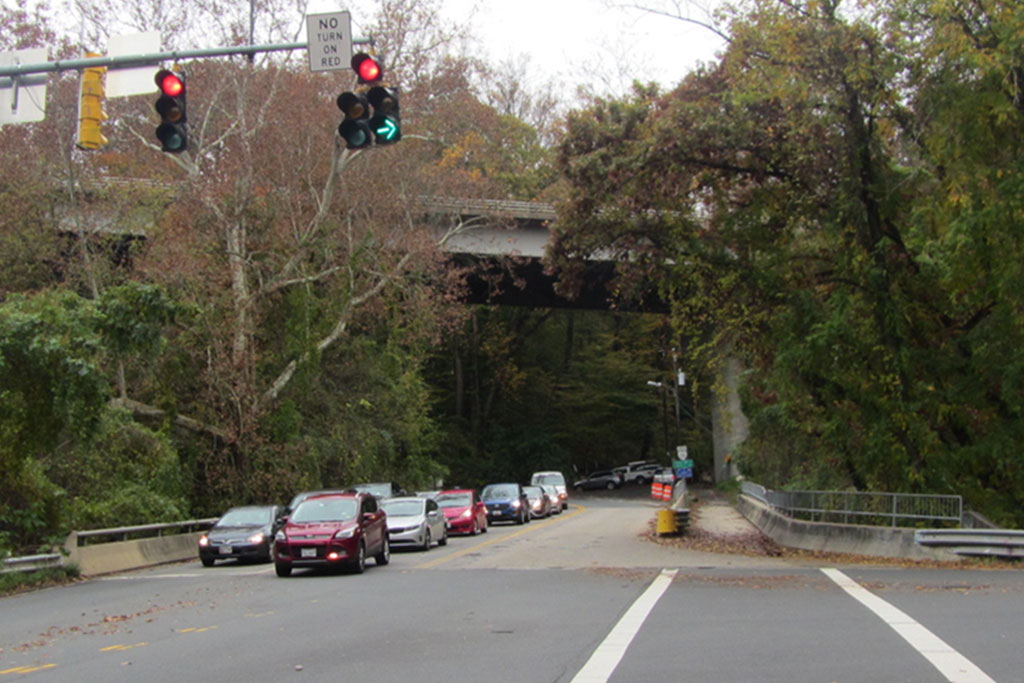
North Glebe Road will have one lane of alternating traffic via flagging along the bridge over Pimmit Run. The traffic signal at North Glebe Road and Route 123 will be turned off during the work and traffic will be controlled via flagging through the intersection. Also under flagging direction will be pedestrians and bicyclists using the path along the bridge over Pimmit Run, and pedestrians using the Potomac Heritage Trail under the bridge.

Drivers should expect delays and are advised to use alternate routes.

The work is part of the North Glebe Road over Pimmit Run bridge rehabilitation project that includes:

  • Replacing bridge beams, deck and barriers
  • Repairing, waterproofing and providing corrosion protection to abutments and piers
  • Replacing barriers and railings along bicycle and pedestrian connection to trails
  • Upgrading guardrails and drainage

The project is scheduled for completion this fall.

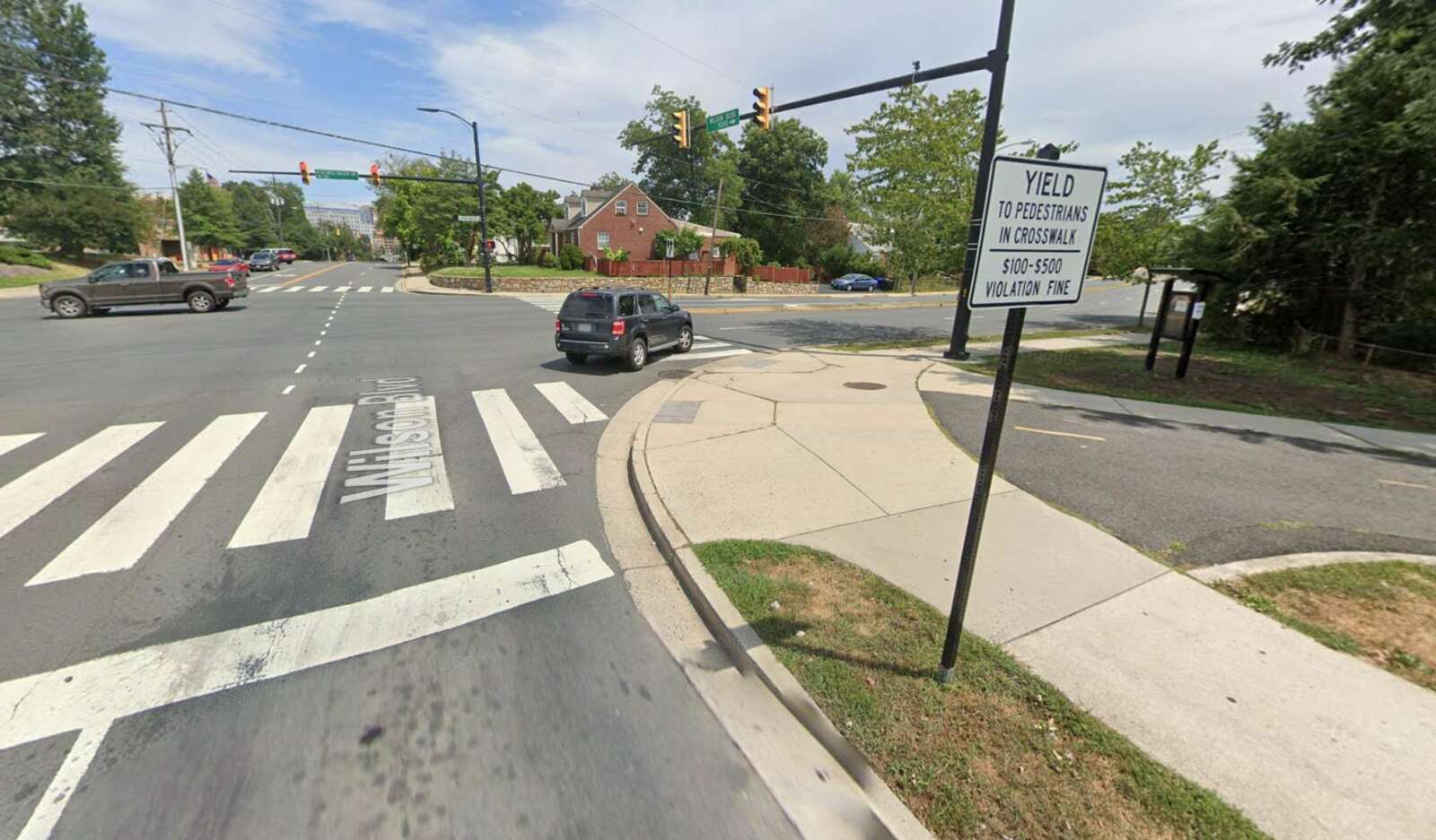
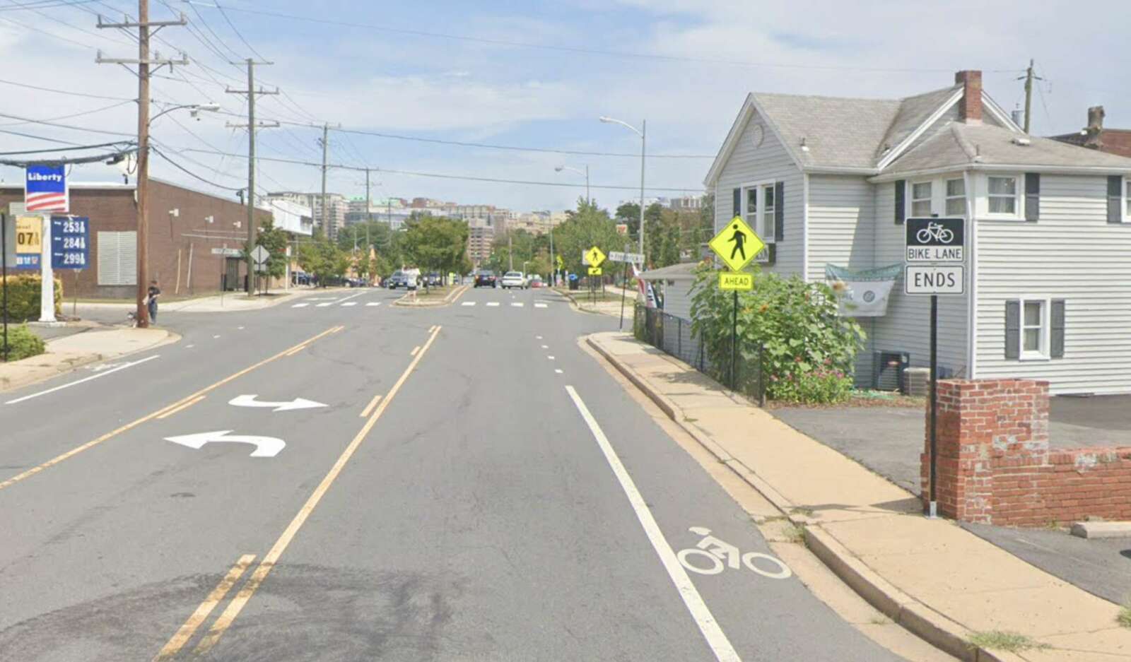
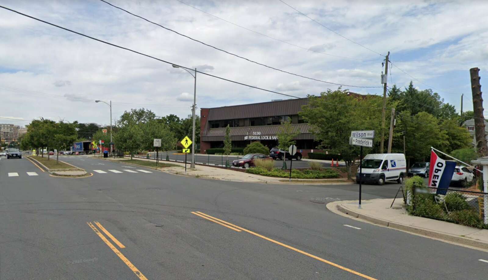
Photo (3) via Google Maps


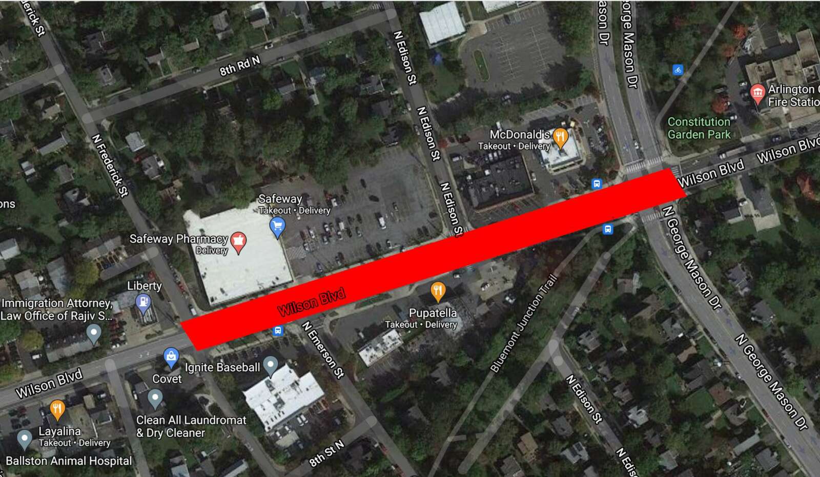
The county plans to resurface a stretch of Wilson Blvd in Bluemont to improve the driving, cycling and walking experience.

The project is part of Arlington County’s annual effort to resurface about 100 lane miles of roadway annually, prioritizing those in the most need of upgrades and those adjacent to development or other capital projects.

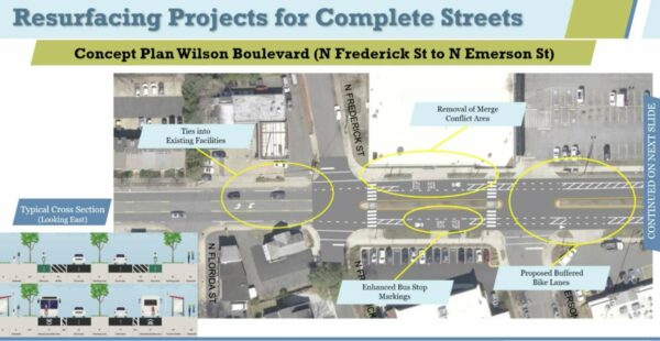
County staff propose reducing — in most places — the number of vehicle travel lanes along Wilson Blvd from four to two between N. Frederick Street and N. George Mason Drive. During a meeting last night (Monday), they said the reduction will accommodate new turn lanes and buffered and standard bike lanes, and prevent merging conflicts where Wilson Blvd transitions from two lanes to one in each direction west of N. Frederick Street.

Transportation Engineer Dan Nabors said the changes will “improve pedestrian crossings, provide separation between people who are driving, walking and biking, reduce and control vehicle speeds, improve sightlines, and make the street easier to understand for all users.”

Currently, east of N. Frederick Street — near the Safeway — Wilson Blvd has two vehicle travel lanes in each direction, curbside transit stops and shared-lane bicycle markings, also known as “sharrows.” The posted speed limit is 30 mph and most people go 33.8 mph, said fellow transportation engineer Cathie Seebauer.

This spring, road users suggested changes to this segment of Wilson Blvd, which staff said they incorporated into the concept plan shared last night. Community members asked for a continuation of existing bike lanes, a safer Bluemont Trail crossing at the intersection with N. George Mason Drive, and changes to the part of Wilson Blvd where it narrows from two lanes to one west of N. Frederick Street, Seebauer said.

Proposed changes to Wilson Blvd from N. Frederick Street to N. Emerson Street (via Arlington County)

From N. Frederick Street to N. Emerson Street, staff propose eliminating the transition from one to two lanes and adding buffered bike lanes that will be shared with enhanced bus stop markings.

“The road does meet national volume thresholds for a reconfiguration from four lanes to two,” Seebauer said. East of N. Edison Street, however, she said that “two eastbound travel lanes would need to be retained to maintain safety and operations.”

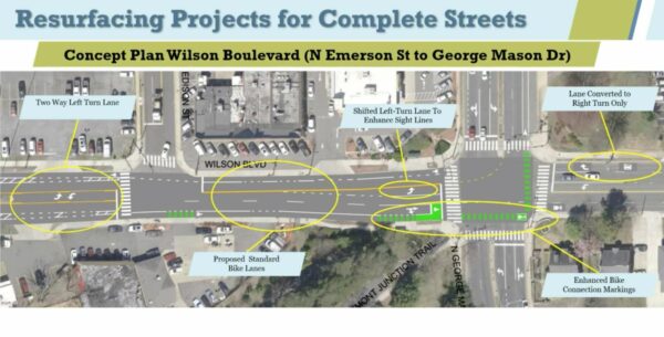
Proposed changes to Wilson Blvd from N. Emerson Street to George Mason Drive (via Arlington County)

From N. Edison Street to N. George Mason Drive, cyclists will have a 6-foot standard bike lane with green paint to warn drivers and cyclists of major conflict points. A two-stage bike box will guide those turning to go north on N. George Mason Drive and help those continuing east on Wilson Blvd to merge with through vehicular traffic when the bike lane disappears.

Wilson Blvd going west will have only one through-lane to make room for dedicated right and left-turn lanes.

An online comment tool will be open until Tuesday, July 7. The resurfacing work will be done this summer and fall.

Photos (1-4) via Google Maps 


Rent Rising in Arlington — “Of the 10 top apartment markets in the D.C. metro tracked by Apartment List, average rents are lower than a year ago in six of them. Arlington County, Virginia, remains the most expensive apartment rental market, with an average monthly rent of $2,144. Arlington County rents are still 9.7% lower than a year ago, but rents have bounced back the most, rising by 2.7% over the past month.” [WTOP]

Local Spots on Spring Dining Guide — Washington Post food critic Tom Sietsema’s prestigious Spring Dining Guide includes three Arlington or Arlington-connected restaurants: Cafe Colline on Lee Highway, Spice Kraft Indian Bistro in Clarendon, and the soon-to-open Lucky Danger in Pentagon City. [Washington Post]

Arlington, D.C.’s Factory District? — From WAMU’s Martin Austermuhle: “Apparently the idea of re-retroceding Arlington and Alexandria to D.C. was being debated in the late 1800s and early 1900s in Congress. Some believed it would give D.C. a bigger tax base, others said Arlington would be a good place for factories. (Not of cheesecake variety.)” [Twitter]

Thieves Steal Cars With Found Keys — “Between 10:00 p.m. on April 25 and 9:38 a.m. on April 26, the suspect(s) gained entry into the victims vehicle parked in their driveway where a garage door opener was located. The suspect(s) allegedly used the garage opener to gain entry into the victims garage where a second vehicle was located with keys for both vehicles inside. The two vehicles, along with the victims personal property and an undisclosed amount of cash, were stolen.” [ACPD]

New Glebe Turn Lane Open — Northbound N. Glebe Road now has an added left turn lane at Lee Highway, after a year of construction. The project is expected to wrap up in the fall. [Twitter]

F.C. Lowers Tax Rate, Renames Schools — The City of Falls Church has lowered its real estate tax rate by 3.5 cents, the first time it has reduced the rate since 2006. The city’s School Board also selected new names for George Mason High School and Thomas Jefferson Elementary. [Falls Church News-Press, InsideNova]


Western Smoke Causing Hazy Skies — “The local National Weather Service office pointed out today in its technical discussion that the smoke is caught in the jet stream and moving overhead around 20,000 to 25,000 feet high. Smoke from the historic fires out West now covers much of the country, and it is expected to continue to be an issue in the days ahead.” [Washington Post, Twitter]

Board Approves Road Project — “Arlington County Board members on Sept. 12 approved a contract worth up to $805,000 for improvements to the intersection of 18th Street North with North Glebe Road and North Wakefield Street, aimed at providing a better walking and biking experience for children and others headed to Glebe Elementary School.” [InsideNova. Arlington County]

Ret. Deputy Seeking Answer to 9/11 Mystery — “Nineteen years after the 9/11 attack at the Pentagon, a retired Arlington Sheriff’s deputy still doesn’t know if the badly injured man he pulled from the burning building survived. He doesn’t know his family or even his name — and Art Castellano still cries about it whenever something reminds him of that day. Now, WUSA9 is trying to help reunite the two men.” [WUSA 9]

Teacher Seeking Desk Donations — “Students across Northern Virginia are turning homes into classrooms, so Arlington art teacher Jeff Wilson decided to rally the community to help. Wilson posted a request online for people to donate their old desks to help students who are learning from home.” [WJLA]

Local Business Legend Dies — “Russell A. Hitt, who helped transform the family business into one of the nation’s largest and most successful general contracting firms, died Sunday at his Falls Church residence. The 85-year-old Arlington native is survived by his wife of 66 years, Joan; four children and 15 grandchildren and six great-grandchildren, many of whom now work at Hitt Contracting Inc.” [Washington Business Journal]

No, the FBI Didn’t Conduct a Raid in Rosslyn — “The FBI’s Washington field office says it did not raid the home of Arlington conspiracy theorist Jack Burkman, despite a Washington Post story that apparently took Burkman’s word that his home had been tossed by federal agents.” [Washingtonian, Daily Beast, Washington Post]


N. Glebe Road is expected to close for nine straight days next year for a bridge rehabilitation project.

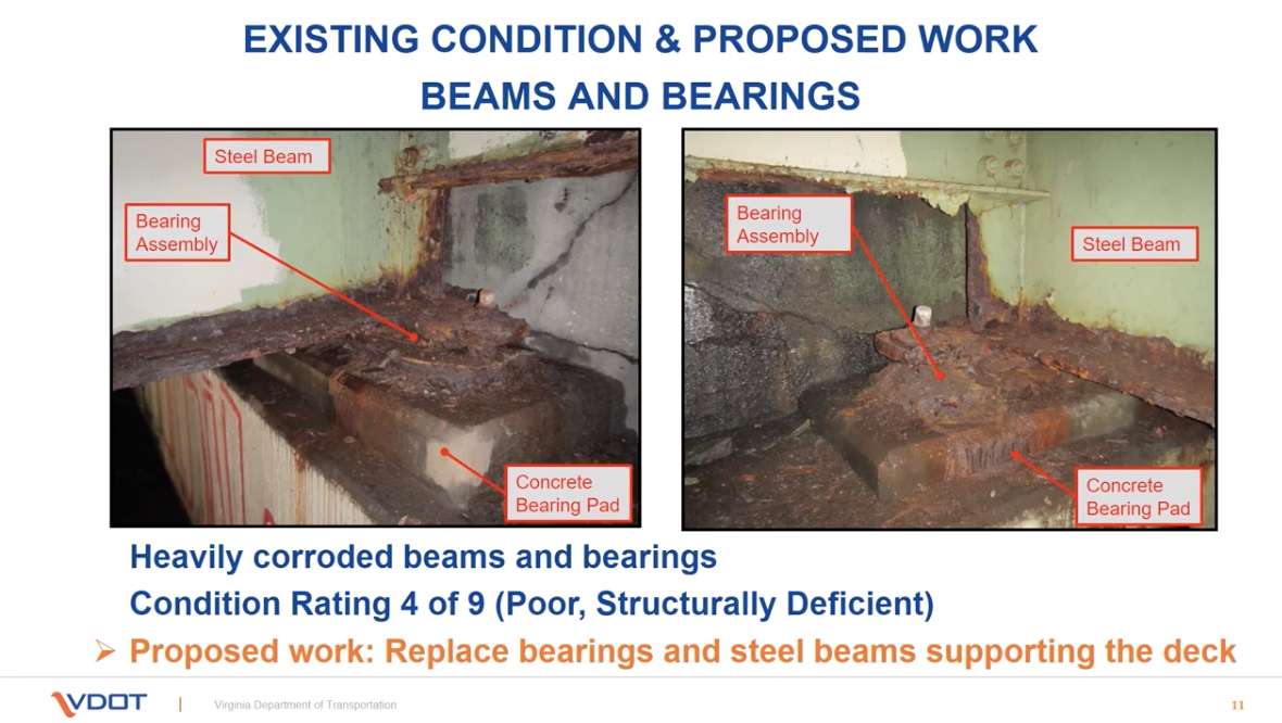
In a recently-posed video presentation, VDOT provided an update on its planned Pimmit Run bridge project. The presentation details the plan to replace the deteriorating bridge deck and steel supporting beams with large, prefabricated components.

Sections of the bridge deck and support beams will be constructed off-site and trucked in, then placed with a crane. That will allow crews to replace the entire top of the bridge much faster than with conventional construction techniques, which would require a sequential series of lane closures.

The downside is that the bridge — and thus N. Glebe Road, just up from Chain Bridge — will need to be closed to traffic entirely for an estimated nine days next year.

The project is set to kick off next spring and wrap up in the fall of 2021. Its projected cost of $9.5 million will come from state and federal funds.

The bridge was built in 1973, serves 13,000 vehicles per day, and is suffering from corroding concrete and steel supports. The project will replace the entire bridge deck and support beams, while also repairing the concrete bridge piers in and around Pimmit Run, near where it flows into the Potomac.

The rehabilitated bridge will have new rails and barriers, as well as a widened pedestrian path.

During the project, traffic heading to and from Chain Bridge will be detoured via McLean and N. Chain Bridge Road. A closure of N. Glebe Road just up from the bridge last week, due to water main work, resulted only in minor traffic impacts — albeit during a pandemic during which many people are working from home.

VDOT is asking for anyone with feedback on the project to email [email protected] by Aug. 7.


The Arlington County Board has approved road improvement projects on three arterial streets and two neighborhood streets.

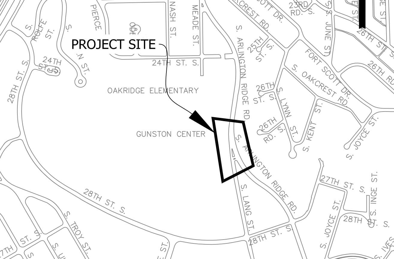
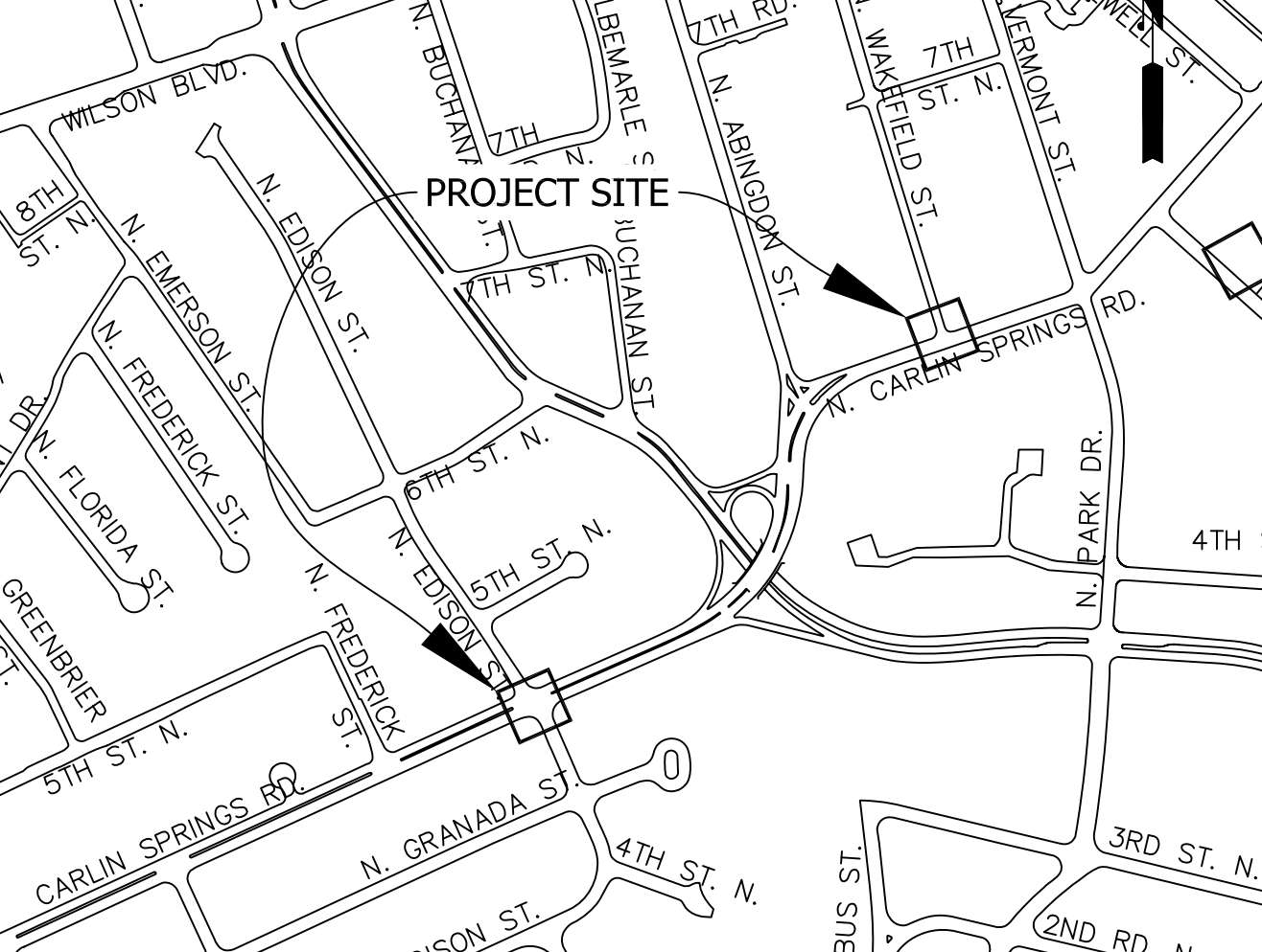
The arterial street projects involve Americans with Disabilities Act improvements to bus stops and ramps, improvements to crosswalks, and other changes to S. Arlington Ridge Road, N. Carlin Springs Road and Military Road — at an estimated cost of $550,000.

More from a county staff report:

The work proposed for the intersection of South Arlington Ridge Road and South Lang Street will provide a safer pedestrian crossing to Gunston School and provide ADA compliant bus stops. The improvements at the intersections of North Carlin Springs Road and North Edison Street and North Wakefield Street will deliver ADA compliant bus stops and installation of a RRFB (rectangular rapid flashing beacon) at the North Edison Street intersection. The project planned for the intersections of 36th Road North and North Marcey Road with Military Road will include ADA compliant bus stops and realignment of the intersection for North Marcey Road for improved vehicle movement.

The Board also approved two “Neighborhood Complete Streets” capital projects, including:

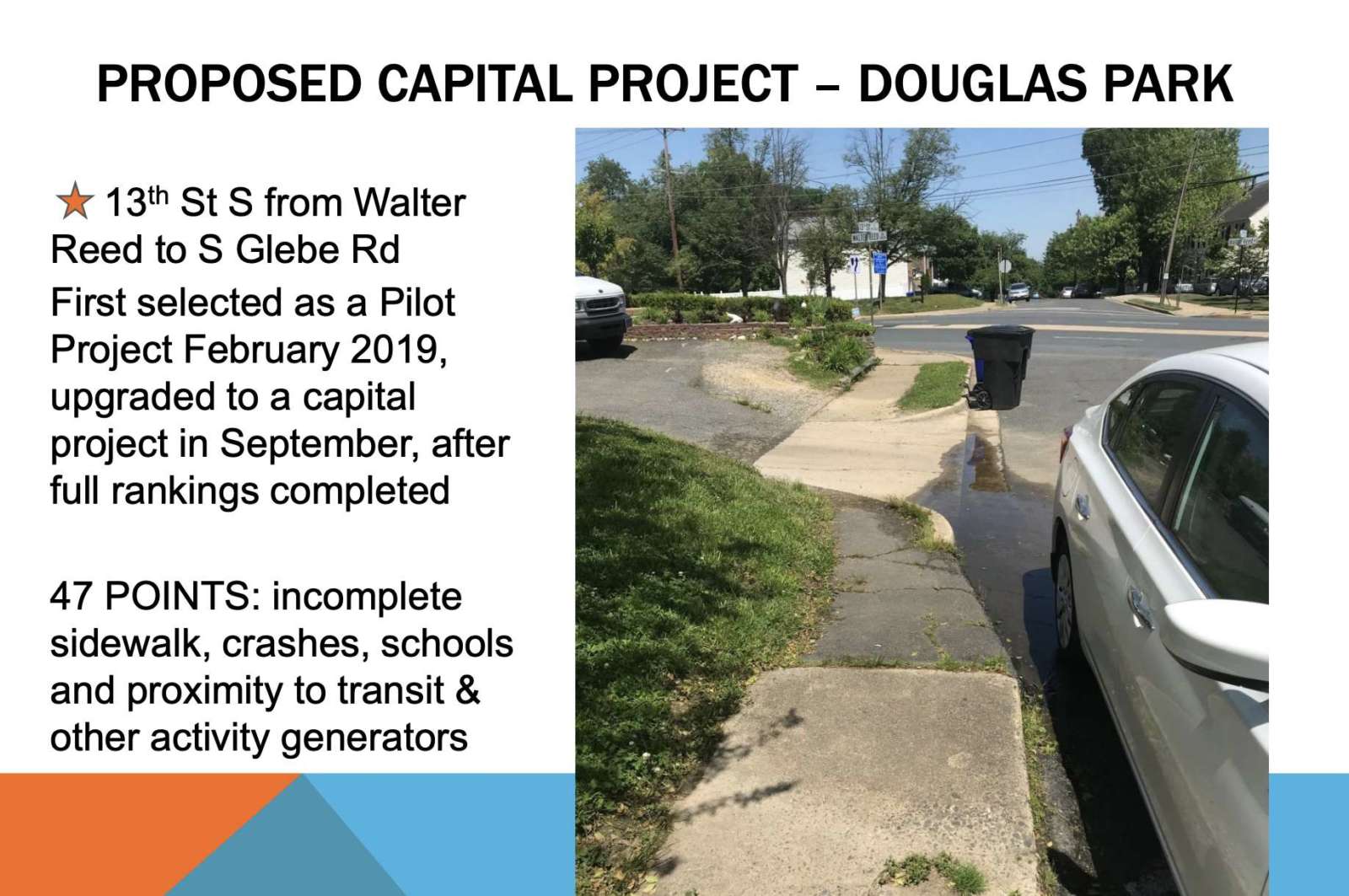
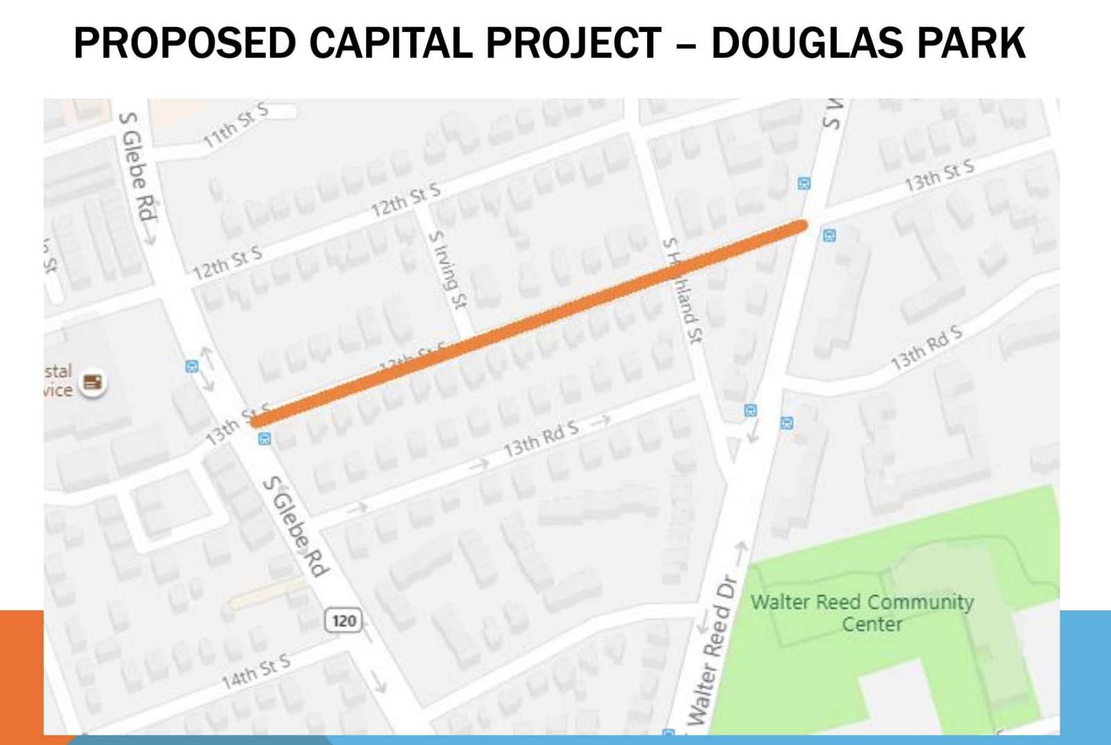
  • New sidewalk, curb ramps, and paving along 13th Street S. between Walter Reed Drive and Glebe Road, in the Douglas Park neighborhood
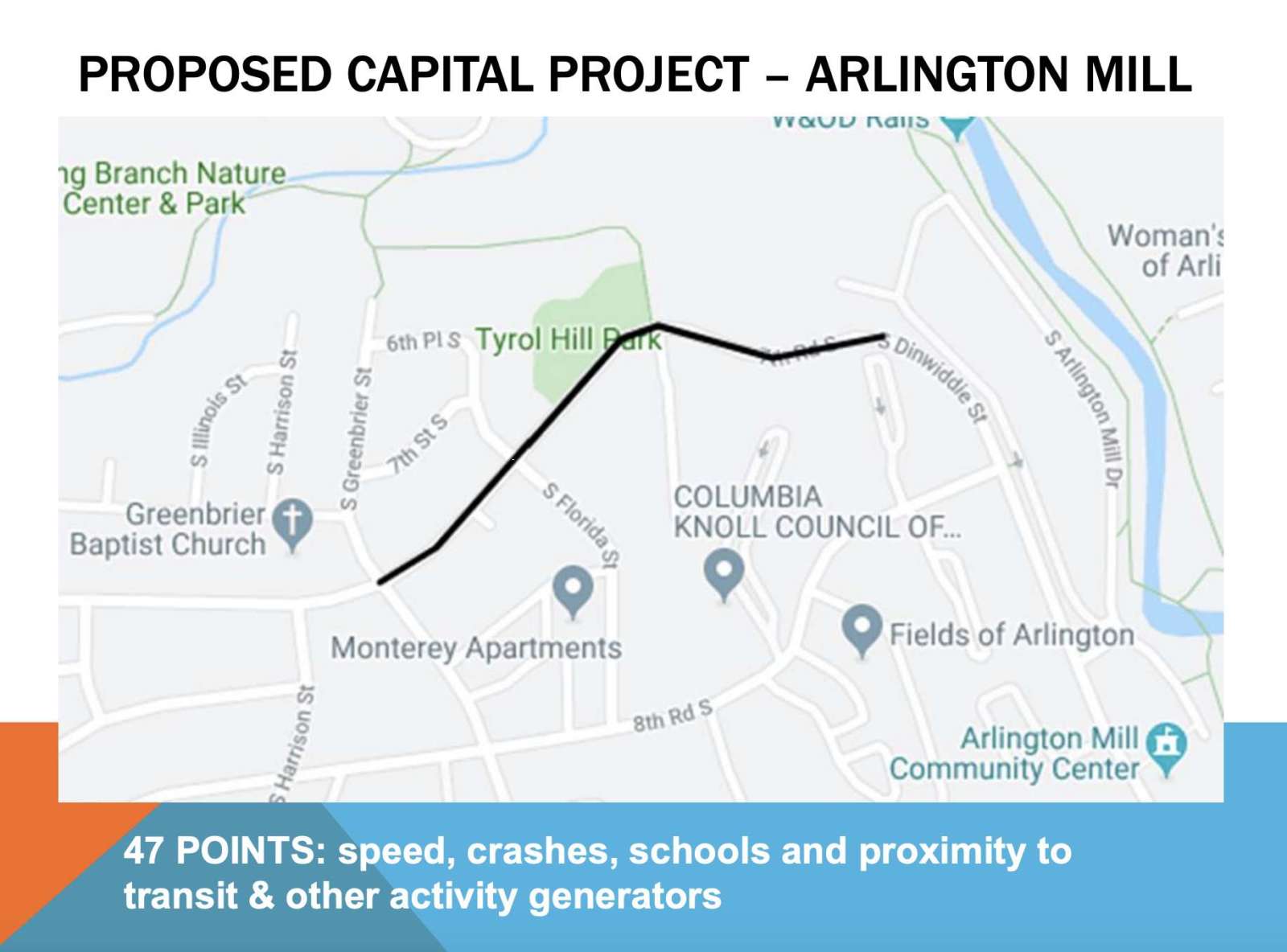
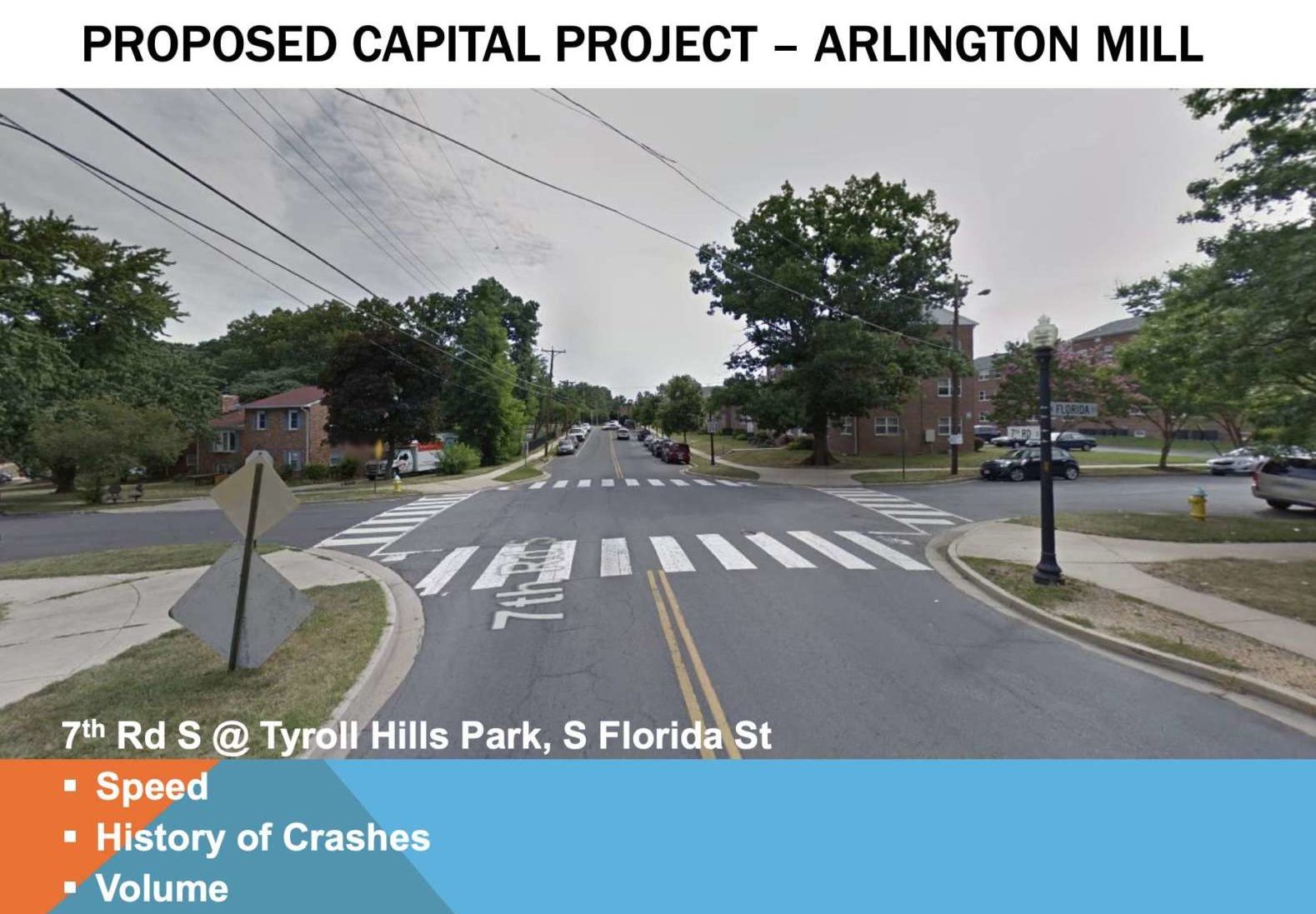
  • Curb extensions and improved bus stops along 7th Road S. in the Arlington Mill neighborhood

The 13th Street project has the goal of a safer pedestrian experience on a street commonly used by cut-through traffic, with an incomplete sidewalk. The 7th Road S. project aims to create “pinch points” to reduce vehicle speeds, on a stretch where speeding and crashes are problematic. Both projects have an approximate cost of $600,000.


View More Stories